1889 Plat Map Index & Images
Whitley County, Indiana
Township Maps
Township maps are between 150-250kb in size.
They may take a while to load with a dial-up connection.
Printable versions are smaller and will fit on standard paper.
Cleveland Township
Cleveland Township Printable Version
Columbia Township
Columbia Township Printable Version
Etna Township
Etna & Troy Townships Printable Version
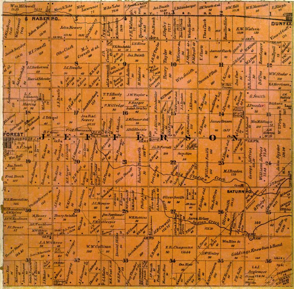
Jefferson Township
Jefferson Township Printable Version
Richland Township
Richland Township Printable Version
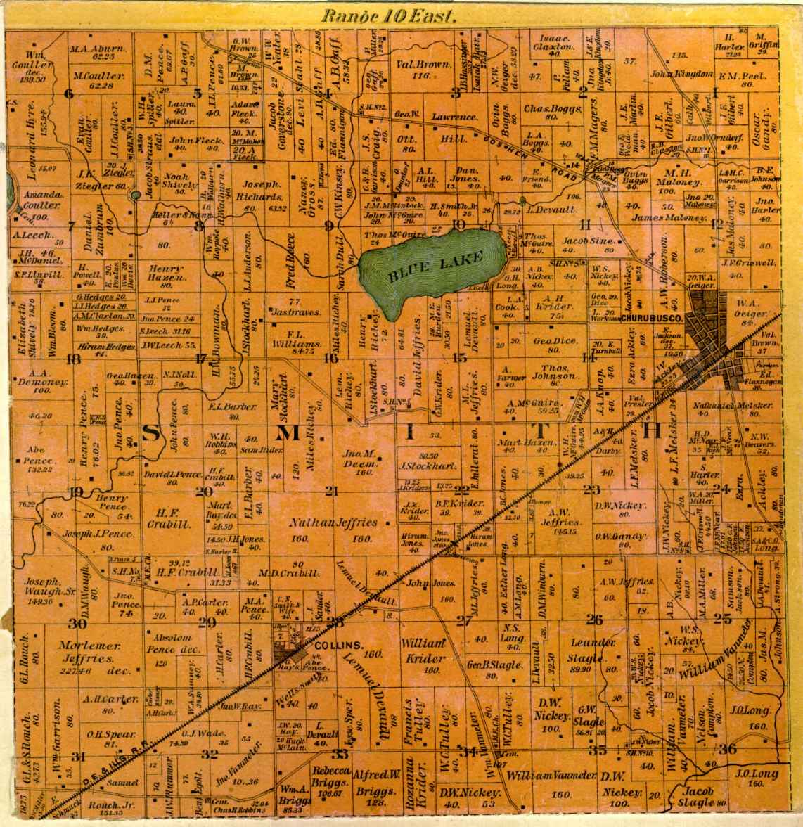
Smith Township
Smith Township Printable Version
Thorncreek Township
Thorncreek Township Printable Version
Troy Township
Troy & Etna Townships Printable Version
Union Township
Union Township Printable Version
Washington Township
Washington Township Printable Version
Churubusco
Churubusco Printable Version
Coesse, Cold Springs & Forrest
Coesse & Cold Springs Printable Version
Forrest Printable Version
Springfield (South Whitley)
Springfield (South Whitley) Printable Version
Plat Map Home Page
A B
C D
E F
G H
I J
K L
M N
O P
Q R
S T
U V
W X
Y Z
Township Maps